What this map is
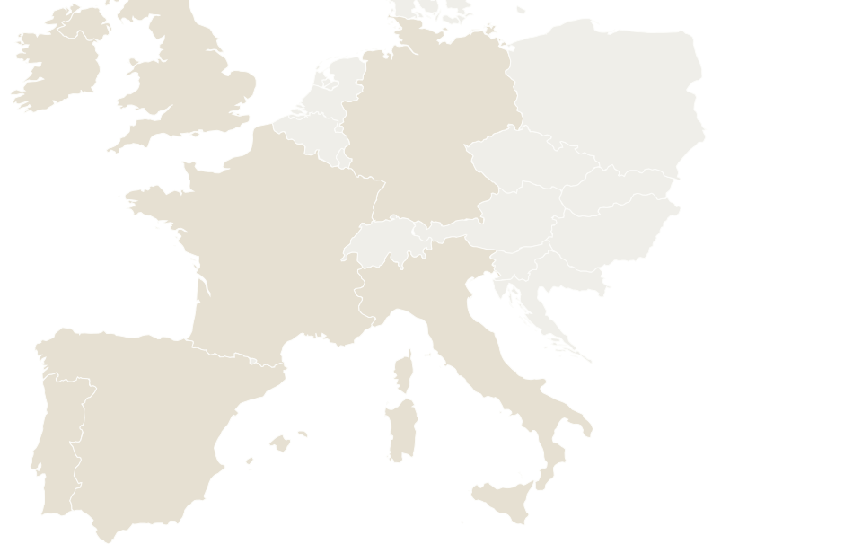
The European Powered-Land Map shows Ampervia’s research coverage: 60 candidates with industrial grid history across 6 countries (Spain, Italy, France, Germany, the United Kingdom and Ireland). 21 sit in priority markets (Barcelona, Milan, Munich and Rhine–Ruhr) where buyers have stated interest; the rest is research and watchlist. On top of these, 8 early leads in Rhine–Ruhr (Düsseldorf–Cologne) and Berlin come from plant closures, insolvencies and listings found in October 2026; their power is not yet checked. None is presented here as an investable opportunity
Powered land is land with a secured, near-term path to the megawatts a data center needs — where the power is solved before construction begins. It can be greenfield or brownfield; the fastest is brownfield — idled or operating industrial sites with high-capacity grid infrastructure nearby. Whether that connection can serve a data center is decided country by country: in Spain, RDL 7/2026 ties demand permits to an activity code, so a new data center request is needed. “Verified” on this map means the site, its industrial grid history and its market status were checked against public records; it does not mean land is under contract or that a data center connection has been confirmed. The connection, not the land, is the scarce asset. This map is the public, redacted view of the brownfield powered land Ampervia originates and verifies node by node — because an old connection is a lead, not proof, and confirming it is the whole job.
A candidate becomes an opportunity only when two conditions hold: a buyer’s requirement fits its location and size, and there is a credible, documented route to power. Until then it stays in research, whatever its score. See the stages.
Coverage by country
| Country | Verified sites | Tier-A | Metro zones | Zones |
|---|
| Spain | 25 | 4 | 3 | Valencia, Barcelona, A Coruña |
| Italy | 16 | 3 | 3 | Milan, Rome, Florence |
| Germany | 10 | 4 | 4 | Dresden, Munich, Mannheim, Essen |
| France | 7 | 5 | 5 | Lyon, Dijon, Bordeaux, Nantes, Lille |
| United Kingdom | 1 | — | 1 | Glasgow |
| Ireland | 1 | — | 1 | Dublin |
Coverage by metro zone
The Ampervia Screen — how a site qualifies
We don't screen public grid data and stop there — we originate off-market powered land and verify it node by node. Every site on the map passes the Ampervia Screen, a four-layer discipline applied in sequence before a site earns a score. The map is deliberately thin because it is filtered, not because the screen is small.
- Layer 1 · Energy-collapse evidence — emissions registries showing the industrial load has stopped or stepped down. Reduced historical demand is a lead, not freed capacity: whether a connection can serve a data center requires the operator’s confirmation.
- Layer 2 · Process records — insolvency and court filings, land records, and administrator processes that define who can transact and on what timeline.
- Layer 3 · Grid watch — system-operator capacity publications tracked monthly across thousands of transmission and distribution nodes, so a site's connection status is current, not archival.
- Layer 4 · Ampervia Score — sites that survive Layers 1–3 are scored and ranked, then tiered by verification depth (Tier-A is the strongest) and re-checked monthly.
How the Ampervia Score works
Each site row carries an Ampervia Score out of 100 — Layer 4 of the Ampervia Screen. It is a modeled composite of five weighted factors — power headroom 25%, permit climate 20%, process clarity 20%, verification depth 20%, return profile 15%. A factor with no reliable input is excluded and the remainder re-weighted, never guessed. Because every mapped site has already passed Layers 1–3, the Score ranks qualified sites rather than flagging risk; a qualified site starts well above the midpoint and only sites strong on every factor approach the 90s. It is an origination signal — not a valuation and not an offer. A score never substitutes for the two conditions above: buyer fit and a credible power route are required before any site is presented as an opportunity.
Frequently asked questions
What is powered land?
Powered land is land with a secured, near-term path to the megawatts a data center needs: the power solved before construction begins. It can be greenfield or brownfield. Whether a connection can serve a data center is decided by the operator and national rules; in Spain a new data center request is needed.
Why are site identities not shown?
Identities and the full per-site dossier are released to Ampervia Club members under confidentiality and non-circumvention terms. The public map shows metro zones and counts only. This protects the owners, the processes, and the buyer’s position.
Does the map show exact locations?
No. Each dot marks a metro zone and is sized by the number of candidates in it. No coordinates, addresses, owners or site names are published.
How do I see each candidate and its score?
Click a zone on the map and register free with a work email and a confidentiality and non-circumvention undertaking. Each candidate in the zone then shows here on the map with its code, MW class, market status and Ampervia Score. Names, towns and owners stay redacted; they are released to Ampervia Club members.
See every candidate with its score →
What this map is
This map shows Ampervia’s early-research leads in the United States: sites that already have power attached, shown at region level. They are leads, not verified sites: no utility has confirmed capacity for any of them, and US research is not yet at the European standard.
In the busiest US markets, asking the utility for new power is slow or paused. The deals that close either buy power that is already in service or have a documented near-term route to it: energized industrial sites, plants that are closing, land beside a substation with spare capacity. Dallas–Fort Worth and Houston are our priority markets; the Great Lakes, Upper Midwest and Southeast leads are a watchlist. See the United States market page for the playbook and sources.
Leads by region
How a lead becomes a verified site
- Confirm the connection: the utility service agreement, its contracted size, and whether it transfers with the property.
- Map the process: ownership, site control, and the path to acquire or partner.
- Grid path: what the utility will allow for a data center load, and a realistic energization date.
- Rank: a site earns an Ampervia Score only once the first three hold.
The public map is deliberately coarse: region level, never the exact site.
Frequently asked questions
What does the US map show?
Ampervia’s early-research leads in the US: sites that already have power attached, such as energized industrial sites and plants that are closing. They are shown at region level and none is verified yet.
Why region level and not exact sites?
Redaction, the same as Europe. Each dot is a region with a count of leads, so no site can be identified publicly. Site detail is released to Ampervia Club members.
How is this different from the European map?
Europe is a larger, verified inventory with scores. The US set is early research: leads found from public listings and closure notices, with no utility confirmation yet.
Why these regions?
Dallas–Fort Worth, Houston and Phoenix are sold-out markets where new grid requests are slow or paused, so sites with live power are what trade. The Great Lakes and Southeast leads are idled industrial sites with an existing grid tie.
How do I get site-level access?
Apply to the
Ampervia Club. Members see each site identified, with its evidence, as it is verified.
Early-research leads from public listings and closure notices, shown at region level. No utility has confirmed capacity for any of them. Site detail is released to Ampervia Club members as each lead is verified.
Read the US playbook →